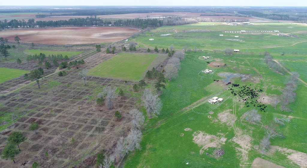
The right side of the image is the southwest portion of White Oak Pastures. The clusters of white-topped structures are our pastured non-gmo GAP5+ turkey sets. You can see by the grass growth where they have rotated around the pasture. The spots where the grass is eaten down are where the turkeys have grazed and it is now recovering. The black spots are the grassfed cattle that are grazing between the turkey sets.
The bottom left is our neighbor who manages this portion of his land for quail hunting. The checkerboard pattern is created by mowing strips through the brush. These strips allow bird dogs to move around more easily so that they can better find quail.
The top left part of this image, and sprawling out to the visible horizon, is conventionally farmed row crop land. These fields will typically be rotated form year to year with an annual monoculture planting of cotton, followed the next year by corn, followed the next year by peanuts. We call this rotation the Southern Trifecta.

